The cabin on Rainy was built sometime in the early60s. I have seen pictures of the cabin under construction. The pictures were among Barb’s photos from before my knowing her. As I vaguely recall, I could see in those photos the handy work of my future father-in-law, Ray, in the fact that the wood that I saw pictured looked second-hand. That is the way things were made in those days. In the 70s and 80s, we were always looking around for items to store in the back of the lot or under the cabin for future projects. Occasionally when we tried to be useful, we pulled out a coffee can of old nails and, one at a time, straightened them with a hammer.
In later years, we did get some new wood into the structure. Sometime in the 80’s, Rick Twaddle came up with Shirley and his boys. Using Rick’s expertise, we tore off the old deck that surrounded the cabin on three sides. We replaced the deck and then put a peaked roof on the cabin that extended over that deck. Previously, the original flat roof leaked, and the peaked roof was a big improvement.
The facilities of the cabin originally included a biffy in the woods. It was on the path to the cabin from the parking location. Just to explain, access to Ray’s land was via an easement through Dr. Crow’s land to our east. So originally, we had to park at the end of a short dirt road and carry luggage, water, food, and ourselves down an incline, along a wooded path by the biffy, and then up a rise to the cabin stairs.
As later improvements, we had a road added that took a sharp turn west from the old parking spot. It traveled over a mound of rock and then down into an area right behind the cabin. I enlarged the new parking lot and built a stone wall to support it. For the wall construction, rocks were pilfered from the lake shore to our east, loaded into Ray’s boat, and returned to our dock. All rocks had to be hauled up the rock shore and back to the lot area. Ultimately the wall was about 7 feet high or more. (I was young – in my 30s.) That parking lot never weakened.
Rick’s first work at the cabin was to complete the work on a new two hole/two room biffy at the south end of the parking lot. The old biffy was retired and torn down.
About 1980 or so, we got further sanitary improvements. A toilet was installed in a small room in the cabin. That is easy to say. However, that toilet required the placement of a sort of half-way sewage container under the cabin. It contained a pump which would activate when the container reached some critical amount. The pump moved the sewage about 50 feet to a large canister which served as a septic tank. That had to be pumped out every year or two. Pumping such tanks is common in areas with cabins and no sanitary sewers.
How could they ever put sanitary sewers up there. There is solid Laurentian granite throughout that area. Grampa (Ray) used to tell about his efforts to get a dock that would withstand the winter at the lake. He hired someone, probably in the early 60s, to try to drive iron rods (rebars) into the rock as supports for the planned dock. Due to the technology of that age, the guy quit after dulling all his drill bits on that Laurentian granite. A couple of the successful rods did remain embedded near the final dock – though they remained unused.
Well, modern infrastructure technology shows that nothing like a little rock can stop progress. (Progress?) Sometime around 2017 or 2018, our City of Ranier began a project to provide a sewer to its eastern-most area. (Our cabin was in Ranier, and we were just west of a town called Island View. All I can think of in Island View was a resort by the same name, Thunderbird Lodge and Sha-sha Lodge plus residences. It is the end of the road before going into Voyageur National Park. 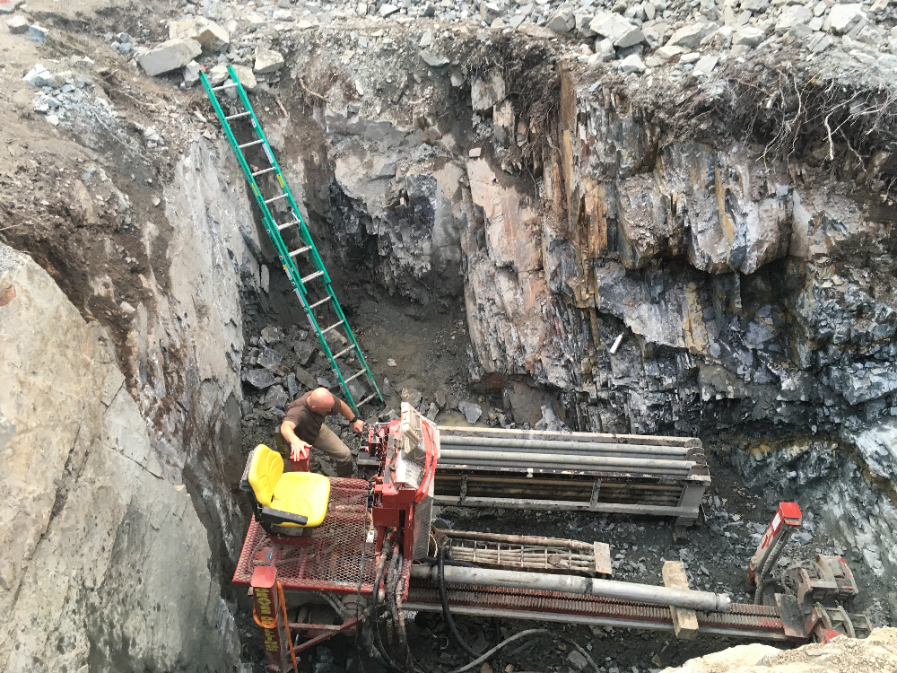
I was never up there during that utility work, but the project just tore through the rock with its modern equipment. Above is a picture of Chris getting on to the drilling rig in a hole which I believe was to serve as access to at least our cabin and maybe other houses in the area. There were 4 or 5 more year-round homes farther east on our point of land. In my mind is the idea that if sewer was being provided then water service would be close behind. All these would add adjustments to the tax bills on the cabin. So, things would be getting more expensive. I don’t know if Chris ever waited long enough to find out the actual charges on the taxes. More about that shortly.
Over the last 20 plus years, Chris and Lisa had maintained the cabin, but it did not seem to serve the family well. Chris - and I - were definitely in love with that place since it had been a significant location in our lives. All of Chris’s life! However, Chris’s family had a constant concern about Liam’s safety while they vacationed up there. In particular, the lake was right there! Liam was not necessarily able to take adequate precautions around water. He needed constant monitoring. The rocky terrain was also an issue. The boulders and rocky-shoreline was often slippery. So it happened that often Chris would open and close the cabin as warm weather came and went, but there were few visits in between those occasions to that abode that was 300 miles north.
After several years of soul-searching, Chris decided that his Grandpa and Mother would understand that selling the cabin was in the best interest of he and his family.
The way I look at it, Chris was able to sell the “best lot of Rainy.” In all of the writing to this point, I have not described our vantage point on Rainy. The cabin was built atop a huge outcropping of rock that could be thought of as the far-northeast corner of Tilson Bay. Across the water from our lot was wild Grassy Island – uninhabited by statute except for Camp Kooch, a young persons camp for summer outdoor adventurers. Camp Kooch was of out of our sight on the east side of Grassy. Our shore of the lake on the mainland side and Grassy Island to the north side formed the two borders of the navigation channel along a southern segment of Rainy extending about a quarter mile east of our land. Our cabin occupied a point of land from which we could view east to wild Sandpoint Island, Ontario (up-lake). Turning, we could look toward islands that separated us from Sand Bay and Fort Francis, Ontario. Beautiful sunsets would capture the western horizon through a narrow channel several times each summer. Beautiful for photography.

A sunrise over Sandpoint Island. (I seldom saw the sun rise.)
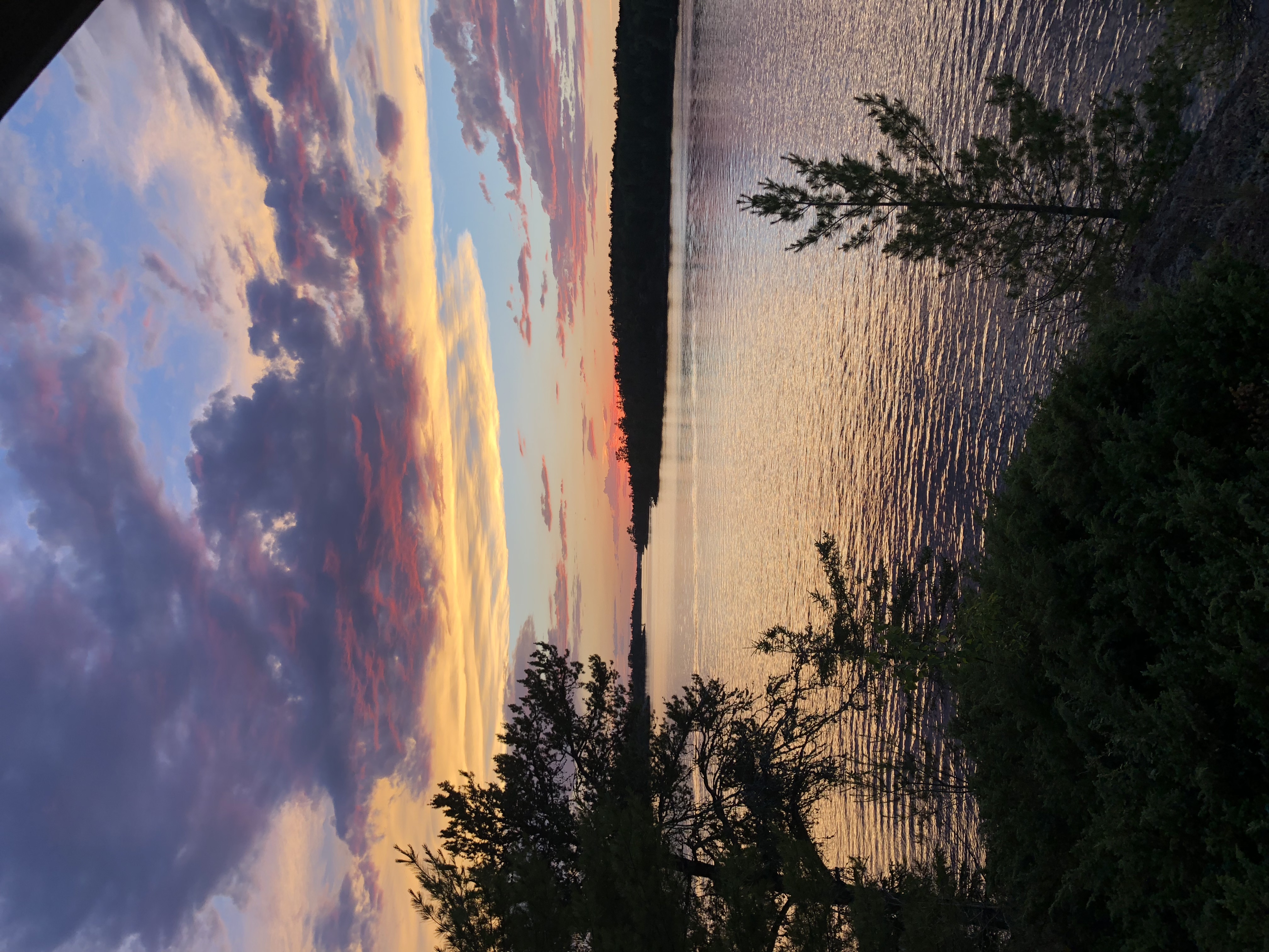
A sunset from the cabin deck looking up the channel to the west.
Memories rush in of things I’ll never see again. I remember driving the boat out of one of our favorite fishing reefs east of Dryweed Island. Out to open water. Canadian islands just north. Looking toward my return route to the cabin some six miles back to the west, I could see that someone had left the light on on our pump house door. It was a beacon home on the darkening lake just after sunset.
Standing on our deck at the cabin, I had the feeling of safety and awe when a storm was coming in from the west – up the channel toward us. The sky would be dark; but between it and the lake, you could see the solid sheet of water coming down disturbing the lake and obscuring the islands it had just passed. It provided the forecast of the weather we would experience in a couple minutes. At least once, that rain was accompanied with a long white “roll-cloud” that forecasted a mighty wind on its way. Get inside!
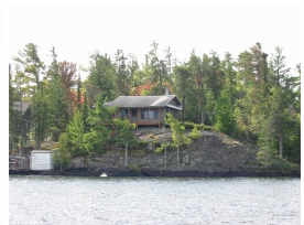
So, Chris put the cabin and lot up for sale. Fortunately for him, there was a short but profitable tug of war between potential buyers. The place finally sold by August, 2019. Needless to say, none of us have been able to follow what has transpired since the sale. Just recently, I decided to see what Google Earth may have recorded via its aerial photography. I was pleasantly surprised. So, the three aerial views come from Google Earth. Images taken from the water have other photographers. This first picture might have been taken by me and shows the cabin perched atop the rocky south shore. Note that the roof shows its weathering from about thirty years of rough snowy winters. The white building at water level is the pump house whose pump supplied water for dishes and personal washing only.
Next I include a capture from Google Earth that shows the aerial view from about 2016. Our cabin is in the upper left with the pump house and dock pointing east along the shore.

For access to our cabin, we shared an easement with the home owner (Larson) in the big grey-roofed house. (Built 2005 or so.) At the building of that house, we called it a "palacial estate." Larson's home was Trump's and ours was the Clampett's.
A third cabin (Hauska's) with a brown roof is on the right.
So, this picture to the left shows the point around 2016. The sale was in 9-2019.
The new owner did not let grass grow under his feet. The status according to Google Earth as of 9-2020 is shown in the following rather blurry image. No construction yet.
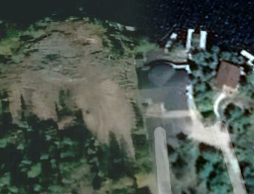
The rock base of the old cabin is leveled and shown as grey in the upper left. The dirt shown to look like a hand pointing south might indicate that fill was dumped in the deep formerly-wooded gully between the two properties. It is a wonder if the result does not leave a ridge next to the neighboring structure. However, hopefully there would be terracing and landscaping. Even then, the water-table might have changed considerably since the area for building was much higher than the neighbor’s lot.
Well, 9-2022 shows an aerial view of the construction. It looked like things were “capped.”
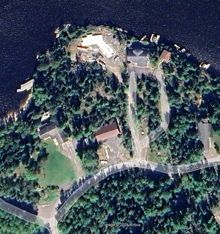
Finally below, the house looks complete at 10-2024. There is no idea if the new owners are living there. In fact, considering other residences farther east of this area (An area referred to as "Gold Shores."), some “little bungalows” like this may just be summer homes.
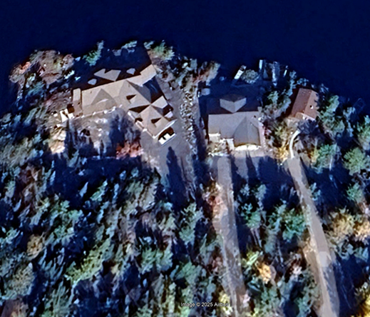
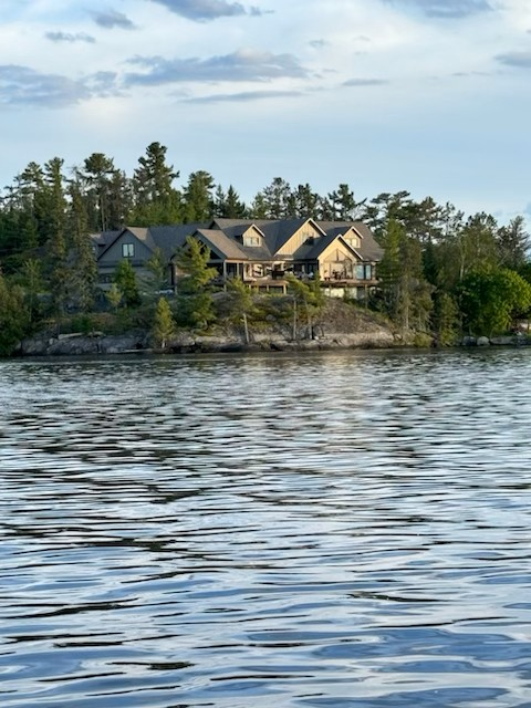
Someone gave Chris a picture of this home from the lake side.
This page on this website might be updated when the aerial photo comes through from 9 or 10-2025. I am interested to see what kind of docks might be added. It would be a shame if they do not add room for a boat – with trolling motor.
